Mt. Bachelor should start to look like this, at least at the start of the storm Friday morning. Photo: Ikon
The season at ski resorts in the Western U.S hasn’t exactly started off with a bang. Small storms have teased the masses, and both mega hills and mom and pops’ slopes have been forced to delay openings. But that might all change this week in what’s being tagged as a series of game-changing storms for ski resorts on the Left Coast.
“The incoming storm will be a complete game changer for many ski areas in the PNW and north/central Rockies,” wrote Powderchasers in one of its signature ‘Epic Alerts.’ “Epic amounts of moisture through Monday. The red flags for chasing are rapidly warming temps in the PNW and upside-down snow in the Rockies with AVY concerns. Ski areas will be deep! Game On! This is what we have been waiting for.”
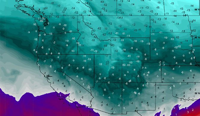
Indeed, most models have the storm coming in cold on Thursday, with another, whiter dose on Saturday, with things warming up through Sunday, when snow levels should rise to 6,000 feet. Still, that means good things for resorts in Washington, Oregon, Idaho, Wyoming, Utah parts of Montana and northern Colorado.

The start of the storm as forecast by Powderchasers. Find more info here.
“If ski resorts were open currently, we would be chasing immediately to the PNW for deepness early this weekend followed by a chase back to the Rockies (ID, WY, UT) for Sunday,” Powderchasers continued. The pow monitoring website regularly suggests places to find the deep. “Our chase would keep us pondering pow in either Wyoming or Utah for Sunday morning and perhaps Colorado for late Sunday to Monday. We would easily be able to score 60-70 inches total by chasing three States from the PNW to the Rockies.”
Basically, lower elevation resorts will see good snow early in the weekend, but look to higher elevations as the work week approaches. Sites like OpenSnow were also tracking the storm in similar fashion. At least two to four feet (upper elevations) are expected, according to forecasts. Avalanche conditions will be significant as the storm gets warmer throughout the weekend and the snowpack goes upside down, so be aware out there.

