
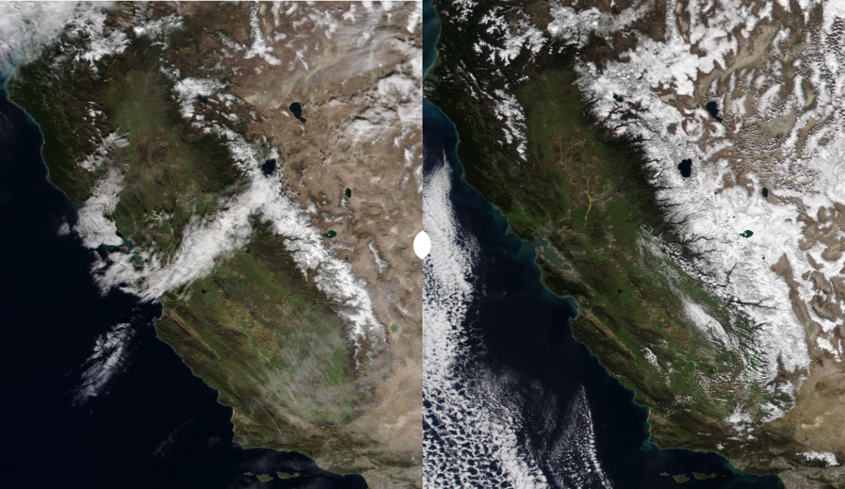
Satellite images show how the Pineapple Express affected California’s Sierra Mountain range on 1/28 (left) and 2/10 (right.) Image: NASA
California’s winter was going full throttle this time last year. In fact, it was almost precisely this time in February and March 2023 that storm activity cranked up to full volume and the Sierra range was getting dumped on at record levels. And by the time summer rolled around parts of the region were still sitting at 1,000 percent of the average snowpack, allowing some resorts to stay open well past their typical dates of operation.
It’s been a much warmer winter for 2023 and 2024, however, which isn’t uncommon for El Niño years in California. California’s Department of Water Resources noted in its first snowpack survey on January 1 that the Sierra snowpack was sitting at just 25 percent of its annual average. But El Niño has also fueled some intense weather events around the Golden State since then, including the atmospheric river and pineapple express events that have taken up headline space since late January and now into the later half of February. By the end of January’s run of storms, the department conducted a new survey and announced that the snowpack had bumped up to 52 percent of its annual average — a significant boost in such a short amount of time.
Recent satellite images provided by NASA showcase how much snow was brought by the atmospheric river that arrived in late January. Even with the state sitting at just about half its average snowpack to end January there is a significant blanket of snow through the Sierra shown in the image taken on February 10, which was just before a whole new round of storms hit the West Coast.
