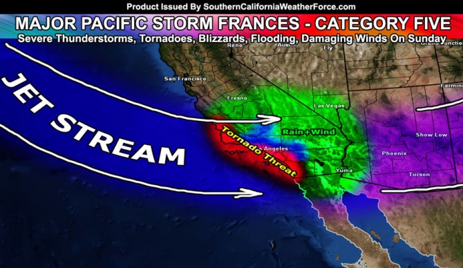
A quick-hitting potent storm system is set to impact Southern California on Sunday, bringing severe weather conditions.
A major Pacific storm that has been watched closely for well over a week has just been classified as a Category 5, a strong system that will bring heavy rainfall, severe thunderstorms, and the potential of tornadoes to Southern California. Yes, tornadoes. Light showers will begin in the region as early as Saturday morning, but as the main storm front moves in late Saturday night into early Sunday morning, weather experts are predicting things could get ugly.
According to the Southern California Weather Force, the center of Pacific Storm Frances will hit the San Luis Obispo, Vandenberg, Santa Barbara, Kern zones on Sunday morning, moving eastward through the Ventura, Los Angeles, Orange County, San Diego, and surrounding zones later in the day.
“The wind gusts with this could realistically hit between 50-70 mph along the front so this has to be watched very carefully, said the SCWF. “Strong southerly flow like this is the first ingredient for severe thunderstorms in the metro areas. The next one is upper divergence … and we have a lot of this. The next is instability and due to the timing of the day this hits … plenty will be available. The last one is directional shear. Much like Major Pacific Storm Eugene had, the strong southerly low level flow will be accompanied by a south westerly flow in the upper levels. This is telling me that the front will have discrete supercell potential with it and plenty of upper level exhaust will be available for tornado potential yet again. The need of a tornado watch is increasing…”
Weather experts are urging Southern California residents to be vigilant, as Pacific Storm Frances is predicted to bring damaging wind gusts, flooding potential, rough seas, and mountain blizzard conditions. Stay safe out there, folks.

