
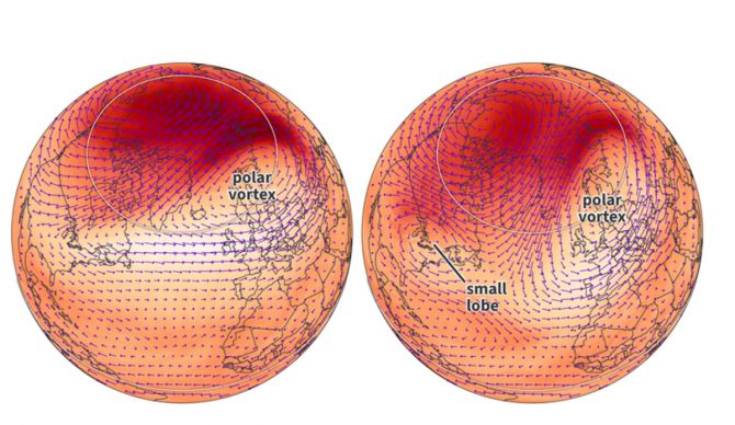
Sudden stratospheric warming events usually come in two possible flavors in which the polar vortex either displaces off the pole or splits into two smaller vortexes. This particular event may be a bit of both. Image: NOAA
There’s a good chance that spring will be a snowy one for parts of the Midwest and Northeast. As spring springs in the Northern Hemisphere, a collapsing polar vortex might mean an unseasonably cold stint of weather for parts of the eastern U.S. and Canada.
According to IFLScience, when the polar vortex — a large area of low pressure and cold air that circulates around Earth’s poles — collapsed in the middle of March, the planet’s weather patterns were redrawn.
“The polar vortex is a low-pressure system of cold air that swirls above both of Earth’s poles,” IFLScience explained. “Over the North Pole, the wind flows counterclockwise in the stratosphere around 16 to 50 kilometers (10 to 30 miles) high. It is closely related to the polar jet stream, a band of strong wind currents that forms at the boundary of the polar vortex. Together, these forces help to trap cold air around the poles.”
When the polar vortex is weakened, that cold air can escape and slip down into the lower latitudes, where spring should be springing and people are ready to shed their winter coats.
So, in mid-March, when a disturbance poked a hole in the polar vortex and allowed that freezing air to escape, it “initiated a series of large-scale pressure changes, setting the stage for cooler conditions in the eastern U.S. and Canada while allowing warmer air to build in the west.”
Now, the long range forecast looks like the eastern part of North America is looking at a chilly bit of weather that will extend into the middle of April. As far as late-season snowfall goes, the dry air might put a damper on big dumps of snow for spring skiing, but time will tell. If you’re an optimist, though, don’t hang up the winter gear just yet.
