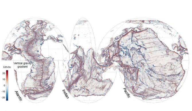
In one year, the SWOT satellite captured more details of the sea floor than in 30 years of prior data collected by older satellites. Image: NASA//SWOT
Even though we live on planet Earth, a huge part of it is a mystery to humans. We’ve only mapped about 25 percent of the sea floor, but a recent push by NASA’s Surface Water and Ocean Topography (SWOT) satellite to shine a light into that darkness has been illuminating, to say the least.
SWOT is only in its first year of operation, but it has already mapped parts of the ocean floor in far more detail than ever before. Launched in December, 2022, the project is a partnership between NASA and France’s Centre National D’Etudes Spatiales. Researchers are now able to study continental boundaries like never before, as well as finding new underwater mountains and volcanoes that older satellites weren’t able to pick up
“Finding these features will really push scientific developments forward, including tectonic theories,” study co-author Yao Yu, a physical geographer at Scripps Institution of Oceanography, told Live Science.
According to Yu, a video created to showcase SWOT’s findings shows “thousands of small uncharted seamounts and previously hidden tectonic structures buried underneath sediments and ice,” and the new maps “will help us to answer some fundamental questions in tectonics and deep ocean mixing.”
SWOT uses cutting edge technology that’s able to detect and measure the ocean’s subtle circulation changes. By tracking the topography of the sea surface, researchers are able to measure the internal waves and their impact on, and around, underwater structures like volcanoes and mountains.
Although SWOT instruments aren’t as detailed as ship-mounted ones, they are far wider in scope and therefore able to capture much more usable information in far less time.
“With the mission still ongoing, SWOT promises critical insights for bathymetric charting, tectonic plate reconstruction, underwater navigation, and deep ocean mixing,” the researchers explained.

