For months now the National Oceanic and Atmospheric Administration’s Climate Prediction Center has been preparing us for a “moderate to strong” El Niño winter. In fact, the first time they alerted our attention to the possibility of any El Niño at all in 2023 and 2024, NOAA said we should all buckle up for a “Super El Niño.” That was back in April and they’ve never really backed off the idea that this winter’s event is likely to be strong. But what does that even mean? Does it mean stronger storm systems, more storms, more snow (or rain), and bigger waves?
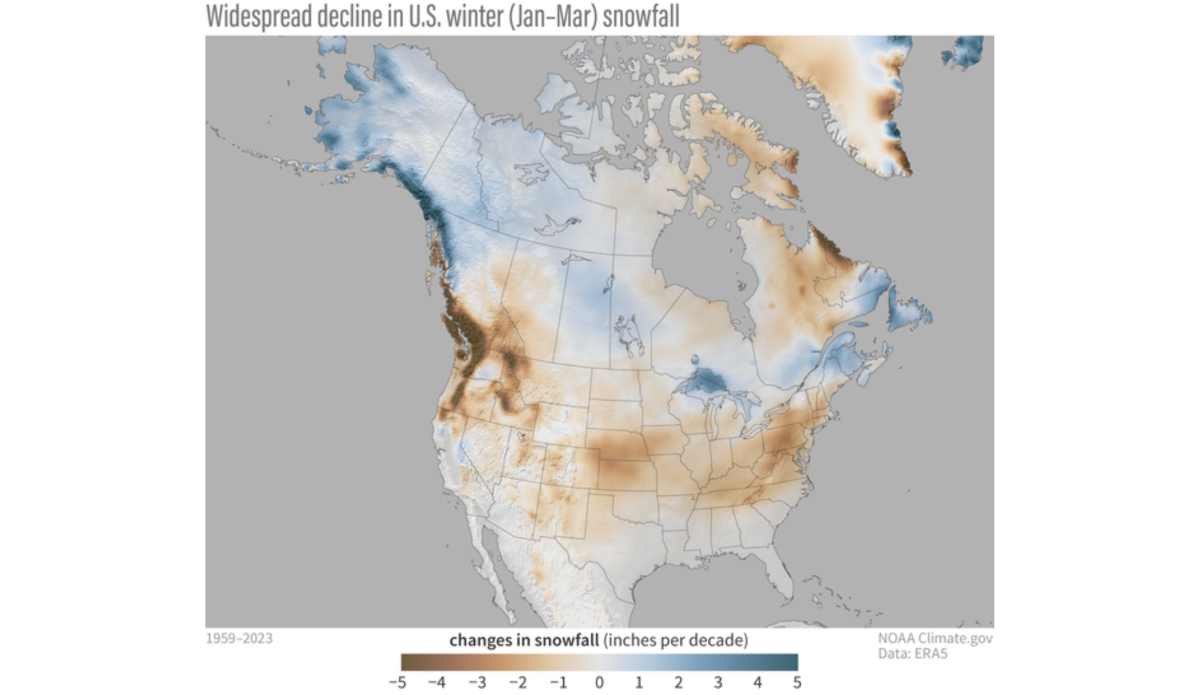
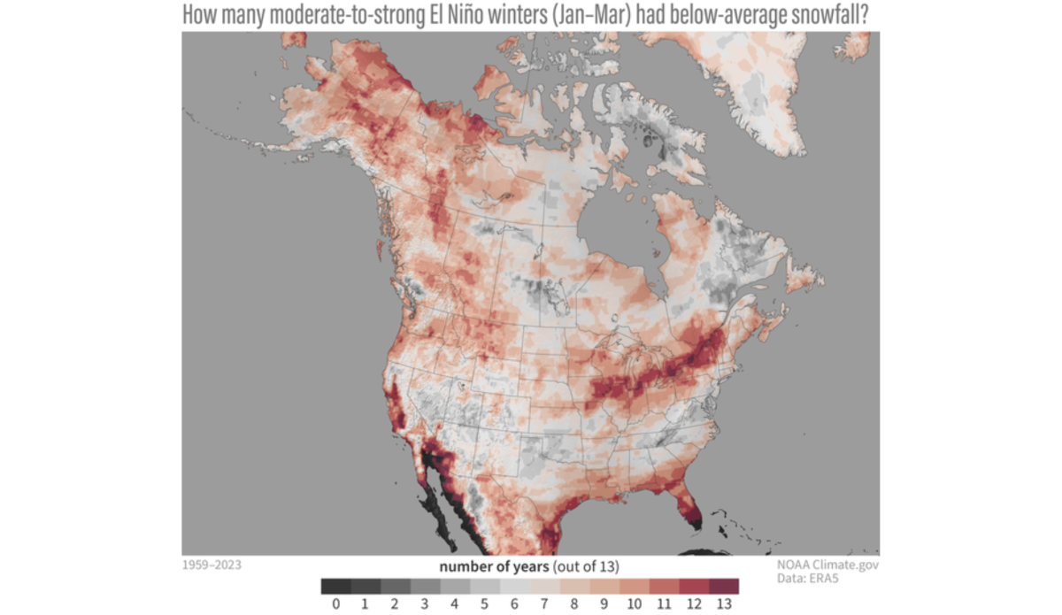
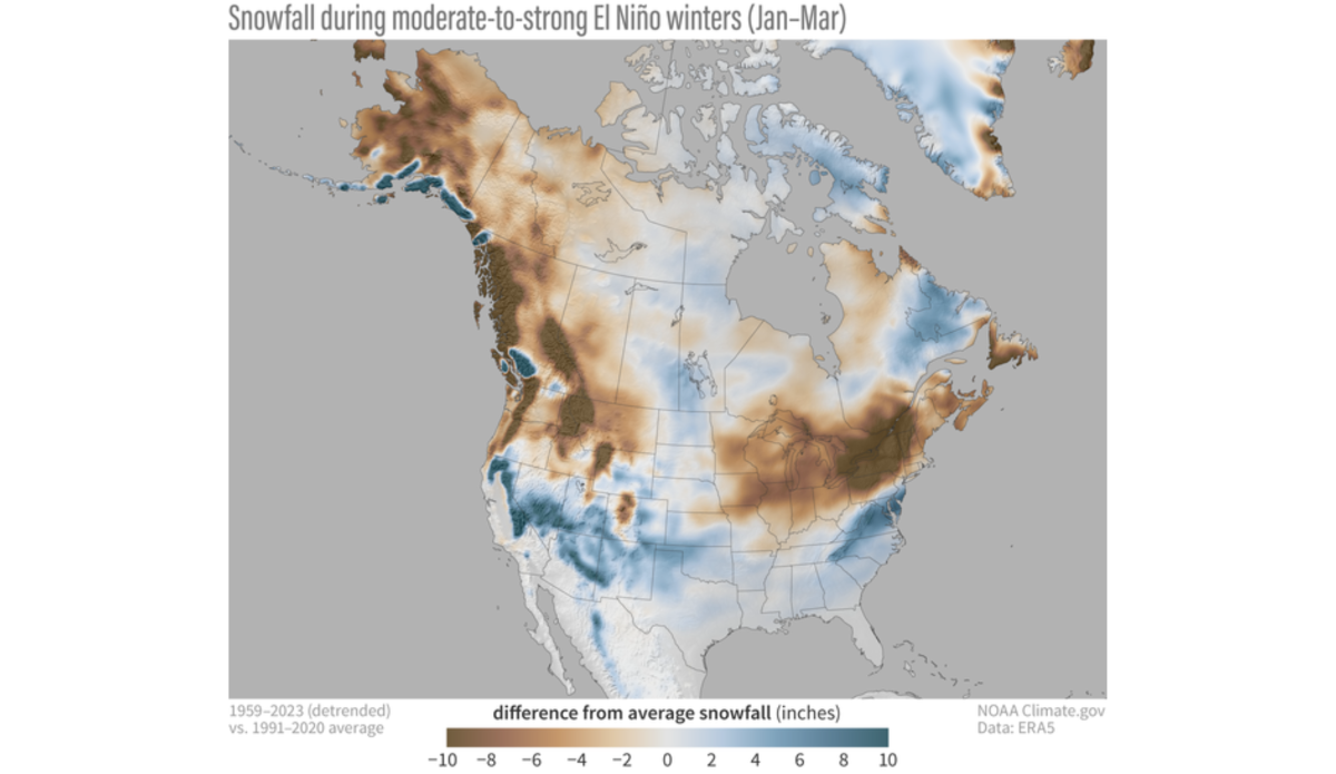
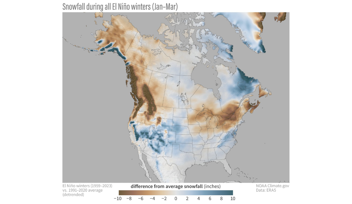
The answer to those questions is specific to where you’re located. El Niño doesn’t just automatically mean “more snow.” And El Niño years can vary, with the strong ones providing stronger anomalies — greater differences from the long-term averages. To make a little more sense of that concept, NOAA Climate Prediction Center blogger Michelle L’Heureux used snowfall datasets from past years to paint a picture of how El Niño has impacted parts of North America in the past. The maps aren’t predictions or forecasts for the upcoming winter, they’re really a portrait of what we do know about the trends of an El Niño.
“El Niño nudges the odds in favor of certain climate outcomes, but never ensures them,” L’Heureux wrote, adding that “stronger El Niño events tend to land a larger punch on our atmosphere, thus increasing the chance of seeing expected El Niño impacts.”
The maps above account for El Niño events between 1959 and 2023. While they might be confusing at first glance, the captions provided by L’Heureux help put them in layman’s terms. What do we actually know about the upcoming winter? Nothing for certain yet. But past trends show the areas that can hit the powder jackpot are the U.S. mid-Atlantic, higher elevations in the Southwest and California, and the South.
“Time will tell, but in the meantime, it is fun to imagine the possibilities,” L’Heureux says.


